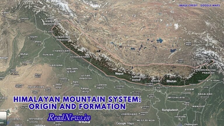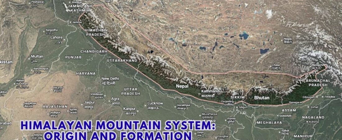


The Himalayas are more than a spectacular mountain range. They are the result of one of Earth’s most powerful geological processes—the collision of the Indian and Eurasian tectonic plates. Their formation began millions of years ago, and the mountains continue to rise and change even today.
Introduction
Stretching across the northern edge of the Indian subcontinent, the Himalayas represent one of the most remarkable geological features on Earth. They contain some of the world’s highest peaks, including Mount Everest, and form a natural geographical barrier between the Indian subcontinent and the Tibetan Plateau. But the Himalayas are not simply a chain of high mountains. They are the visible expression of a massive tectonic process that has been unfolding for tens of millions of years.
The Himalayan Mountain System developed because the Indian Plate moved northward and collided with the Eurasian Plate. This was not a sudden event but a prolonged geological process involving the closing of an ancient ocean, compression of sedimentary rocks, folding, faulting and uplift. The process continues today, which is why the Himalayas are considered geologically young and tectonically active mountains.
Understanding their origin therefore requires looking far beyond the present landscape. The story of the Himalayas begins when the Indian landmass was located much farther south and was separated from Eurasia by the ancient Tethys Ocean.
The Ancient Tethys Ocean
Millions of years ago, the geography of the Earth looked very different from today. The Indian landmass was part of the ancient southern supercontinent Gondwana, which also included Africa, South America, Antarctica, Australia and other continental fragments.
India gradually separated from Gondwana and began moving northward as an independent tectonic plate. Between India and the Eurasian landmass lay the Tethys Ocean.
The Tethys was not merely an open body of water. Over millions of years, rivers flowing from surrounding landmasses carried enormous quantities of sediments into it. Sand, mud, limestone and other materials accumulated on the ocean floor.
These sediments later became extremely important in Himalayan formation. When the Indian Plate moved toward Eurasia, the sediments deposited in the Tethys region were compressed, folded and uplifted. Some of the rocks found in the Himalayas today are therefore evidence of this ancient marine environment.
This is one reason geologists have found marine fossils and sedimentary rocks at remarkably high elevations in the Himalayan region.
Movement of the Indian Plate
The decisive stage in Himalayan formation began when the Indian Plate moved rapidly northward.
Plate tectonics provides the basic explanation for this movement. Earth’s outer shell is divided into large tectonic plates that move slowly over the softer material beneath them. India was carried northward as part of this system.
As the Indian Plate approached Eurasia, the Tethys Ocean gradually became narrower. Oceanic crust was consumed through subduction processes, while sediments accumulated in the narrowing ocean basin.
Eventually, the Indian continental crust reached the Eurasian continental margin.
This was fundamentally different from a typical oceanic-continental collision. Continental crust is relatively buoyant and does not easily sink deep into Earth’s mantle. Instead, the two continental masses began pushing against one another.
The result was enormous compression.
Collision Between India and Eurasia
The collision between the Indian and Eurasian plates is the central event in the geological history of the Himalayas.
When two continental plates converge, the crust has nowhere easy to go. Instead of simply disappearing beneath the other plate, it becomes shortened, thickened and deformed.
Imagine pushing a carpet against a wall. The carpet does not vanish; it develops folds and rises upward. On a vastly larger geological scale, something similar happened when India collided with Eurasia.
The sediments and rocks of the former Tethys region were folded and thrust upward. Large faults developed, and huge sections of the Earth’s crust were displaced over one another.
Over millions of years, this compression produced the Himalayan mountain chain.
The collision also contributed to the uplift of the Tibetan Plateau, which lies immediately north of the Himalayas.
Formation of the Himalayan Ranges
The Himalayas are not a single uniform wall of mountains. They consist of several roughly parallel geological and geographical zones.
From south to north, these are commonly described as the Shiwalik or Outer Himalaya, Lesser Himalaya and Greater Himalaya, followed farther north by the Trans-Himalayan region.
Each zone reflects differences in geology, elevation and the processes that shaped it.
The Shiwalik or Outer Himalaya
The Shiwalik Range forms the southernmost Himalayan belt.
Compared with the higher Himalayan ranges, the Shiwaliks are relatively young and consist largely of sediments eroded from the rising Himalayas. Rivers carried enormous quantities of gravel, sand and mud southward, where these materials accumulated and later became consolidated into rock.
The Outer Himalaya therefore provides an important example of how mountain building and erosion are connected.
As the Himalayas rose, erosion simultaneously wore them down. The eroded material did not simply disappear; much of it became part of younger sedimentary formations.
The Lesser Himalaya
North of the Shiwaliks lies the Lesser Himalaya.
This region contains a complex mixture of sedimentary and metamorphic rocks. Its elevations are generally lower than those of the Greater Himalaya, but the landscape is deeply dissected by rivers and valleys.
The Lesser Himalaya was strongly affected by folding, faulting and thrusting during the continued collision of the Indian and Eurasian plates.
The Greater Himalaya
The Greater Himalaya contains some of the highest peaks on Earth.
This zone includes enormous mountain systems and extensive areas of highly metamorphosed and crystalline rocks. Mount Everest, Kanchenjunga and numerous other major peaks belong to the broader Himalayan high-mountain region.
The extreme elevation of this belt reflects the enormous amount of crustal shortening and thickening associated with continental collision.
However, elevation alone does not explain the present shape of these mountains. Glaciers, rivers, landslides, weathering and other erosional processes have continuously modified the landscape.
Folding, Faulting and Thrusting
Three geological processes are particularly important in understanding Himalayan formation: folding, faulting and thrusting.
Compression causes layers of rock to bend, producing folds. In other areas, rocks fracture and move along faults. Thrust faults are especially important in the Himalayas because they allow older rock formations to be pushed over younger ones.
Major Himalayan geological structures, including the Main Central Thrust, Main Boundary Thrust and Main Frontal Thrust, reflect different stages of crustal deformation.
These structures are also significant from a modern perspective because the Himalayan region remains tectonically active.
The Indian Plate continues to move northward, although the movement is extremely slow when measured on a human timescale. Over geological periods, however, even a few centimetres of movement each year can produce enormous changes.
Why Are the Himalayas Still Rising?
A common misconception is that the Himalayas are a finished mountain system.
They are not.
The Indian Plate continues to converge with the Eurasian Plate. This ongoing tectonic activity continues to deform and uplift parts of the Himalayan region.
At the same time, erosion works in the opposite direction.
Rainfall, rivers, glaciers, landslides, frost weathering and temperature changes constantly remove material from the mountains. Therefore, the present Himalayan landscape represents a dynamic balance between tectonic uplift and erosion.
This dynamic nature is one reason the Himalayas experience frequent earthquakes and landslides.
The 2015 Nepal earthquake, for example, demonstrated that the enormous tectonic forces responsible for Himalayan formation remain active.
The Role of Rivers and Glaciers
Tectonic forces created the basic mountain architecture, but rivers and glaciers have shaped its detailed appearance.
Major rivers such as the Indus, Ganga and Brahmaputra and their tributaries cut deeply through the Himalayan landscape. Over millions of years, they have carved valleys, transported sediments and contributed to the formation of plains farther south.
Glaciers have also played an important role, particularly at higher elevations. They carve valleys, transport rock debris and help shape distinctive mountain landscapes.
The relationship between mountains and rivers is especially important because Himalayan rivers carry enormous quantities of sediment into the Indo-Gangetic Plain.
In this sense, the Himalayas cannot be understood separately from the great river systems that originate within them.
The Himalayas as a Young Mountain System
Compared with very old mountain systems, the Himalayas are geologically young.
Their youth is reflected in their steep slopes, rugged terrain, high seismic activity and continuing tectonic deformation.
Older mountain ranges have generally experienced much longer periods of erosion and weathering. The Himalayas, by contrast, are still being actively modified by geological forces.
Their formation also illustrates an important principle of Earth science: mountain building is not a single event. It is a prolonged interaction between tectonic forces that build relief and surface processes that reduce it.
The Himalayas are therefore both being created and destroyed at the same time—created through tectonic uplift and gradually worn down through erosion.
Why the Himalayan Formation Matters
The origin of the Himalayas has consequences far beyond geology.
The mountain system strongly influences the climate of South Asia. It acts as a major barrier to cold continental air from Central Asia and helps shape the Indian monsoon by influencing atmospheric circulation and rainfall patterns.
The mountains also store enormous quantities of water in glaciers, snowfields and high-altitude lakes. Rivers originating in the Himalayan region support hundreds of millions of people across South Asia.
The Himalayan landscape has also influenced agriculture, settlement, trade, culture and political geography for thousands of years.
Thus, the story of Himalayan formation is simultaneously a geological story and a story about human civilisation.
Conclusion
The Himalayan Mountain System is the product of one of Earth’s most powerful and continuing geological processes. Its roots lie in the ancient Tethys Ocean and the northward movement of the Indian Plate after its separation from Gondwana. As India collided with Eurasia, the ocean narrowed and eventually disappeared, while sediments and continental rocks were compressed, folded, faulted and thrust upward.
Over millions of years, this immense collision produced the Himalayas and contributed to the uplift of the Tibetan Plateau. Yet tectonic forces alone do not explain the mountains we see today. Rivers, glaciers, rainfall, weathering and landslides have continuously reshaped the rising terrain.
What makes the Himalayas particularly fascinating is that their geological story has not ended. The Indian Plate continues to converge with Eurasia, while erosion simultaneously wears away the mountains. Earthquakes and landslides are reminders that the region remains active.
The Himalayas, therefore, should not be viewed simply as a static collection of high peaks. They are a living geological system—one that records the movement of continents, the disappearance of an ancient ocean and the extraordinary power of plate tectonics. Their mountains are, in a very real sense, the visible result of Earth’s restless interior.
Disclaimer
This article is intended for educational purposes. Geological interpretations and estimates of the timing and stages of Himalayan formation may be refined as new research and geological evidence become available.